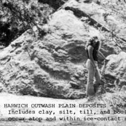

The Cape is a short work that engages the history of visual print-based authority by combining impersonal, government-created images with a purportedly personal story. Carpenter animates decades-old black-and-white photographs, illustrations, and maps, adding to these a few laconic caption-sized texts to extend an exploration of "place" that digital space evokes.
Author description: Why do we trust our memories but doubt our doubts? The Cape conflates fact and fiction. Cape Cod is a real place, but the events and characters of The Cape are mostly made up. The diagrams are not to scale. The maps are accurate, but out of date. I didn't take any of the photographs and anyway, they have all been retouched. The Cape was written, designed, built, and copyrighted by me, J. R. Carpenter, in 2005. Many DHTML and javascripts were injured during the making of this web site. I used HomeSite 4.0 for everything except the timelines, which I plotted in Dreamweaver. All other credits remain intact inside the source code. To navigate The Cape, click on the images at the bottom of the screen. I generally read from left to right, but you can read in any order you like. There are no special instructions or requirements for viewing this piece, except for possibly: Don't believe everything you read.
Instructions: To hear the sound, turn on the computer's speakers or plug in headphones. Move the mouse and click to progress through The Cape.
Previous publication: The Cape was published in print in Carve Magazine, Montréal, Québec, Fall 2005. On the web, The Cape is available as part of The First Independent Free Internet Art Gallery, at http://www.bestonweb.net/wett.htm and at Carpenter's own site http://www.luckysoap.com since January 2006.
Creative Commons Attribution-NonCommercial-NoDerivs 2.5 License.